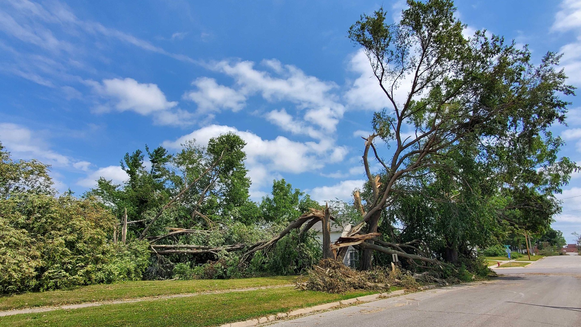
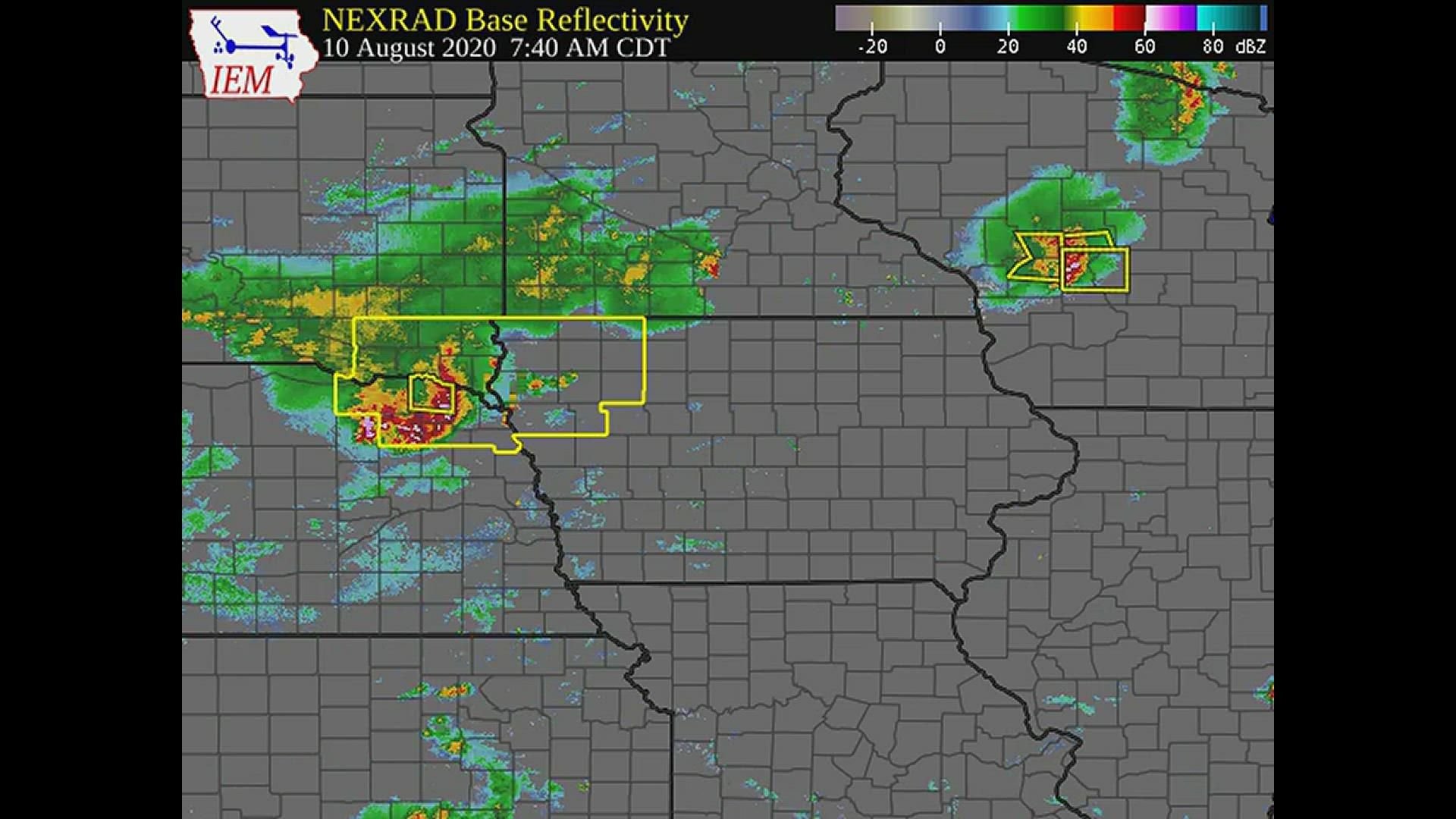
DES MOINES, Iowa — How could the costliest thunderstorm in United States history be so poorly forecast?
Yes, meteorologists mentioned the possibility of severe weather on Aug. 10 last year, but the message to the public wasn't all that different from any other severe weather day in Iowa.
Researchers are working to improve severe weather forecasting following August 2020.
Warn-on-Forecast System (WoFS) is a National Oceanic and Atmospheric Administration (NOAA) research program that aims to improve warning lead times for tornadoes, severe thunderstorms and flash floods.
Increasing warning lead time and accuracy would reduce loss of life, injury and economic damage caused by severe weather.
How does it work?
High-resolution surface, satellite and radar data is rapidly computed by multiple computer models.
WoFS takes the full range of possibilities computed by those models and turns it into a probabilistic forecast. This provides forecasters the odds certain hazards will occur in a specific area.
"When we issue a forecast using the model, we can predict the track and intensity of individual thunderstorms," said Patrick Skinner, meteorologist at the University of Oklahoma's Cooperative Institute of Mesoscale Meteorological Studies (CIMMS).
Unlike weather prediction models currently used by meteorologists, WoFS forecasts can be generated multiple times an hour.
This nearly constant flow of information could help the National Weather Service issue warnings farther in advance.
"For those (other models), they can do a really good job of predicting where storms develop on a regional scale, but you can't say there's going to be a storm in this county at 5 pm tomorrow," Skinner added. "That's where the Warn-on-Forecast System comes in."
WoFS is best used about 3-6 hours in advance of a storm's arrival and operates best once the storm of interest develops.
Since it is still in its experimental phase, WoFS is not currently capable of running every day.
Research scientists pick about 50 days a year to operate WoFS when severe weather is expected.
They did not run it on Aug. 10, 2020 since significant severe weather was not expected. But a look back after the event provided some encouraging results.
The predictability of the derecho
Aug. 10, 2020 was a challenging day to forecast.
Weather forecast models showed a wide variety of possibilities from potential severe weather to no rain at all.
Due to low confidence, the Storm Prediction Center only had Iowa in a marginal risk for severe storms early that morning.
Models struggled most with where and how many storms would develop the night before in Nebraska and Iowa.

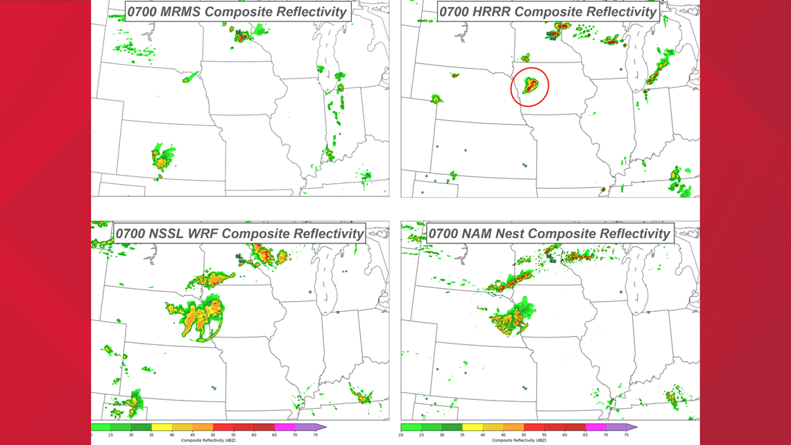
Had storms occurred in Iowa Sunday night, the derecho almost certainly would not have happened.
Since Iowa ended up staying dry that night, the environment became primed for severe weather the next day.
The question then transitioned to whether or not storms in South Dakota would move into Iowa during the day of Aug. 10. It turns out they did, racing eastward across Iowa into Illinois.
"There had to be a whole series of other events that either did or did not happen in a specific order in order to have the environment right for the development of a derecho," Skinner said.
Clearly, the traditional weather models did a poor job handling this event.
Would WoFS have helped forecasters?
Skinner and his colleagues at NOAA and the University of Oklahoma decided this event was worth a retrospective study.
What they found was both surprising and encouraging.
At 10 p.m. on Sunday, Aug. 9, WoFS showed a high probability of widespread, severe wind gusts in northern Iowa.

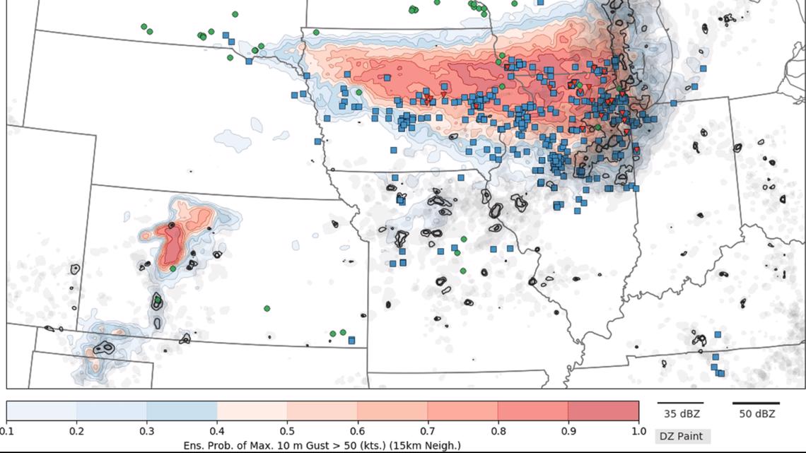
By 6 a.m. on Monday, Aug. 10, WoFS continued to show a high probability of severe wind, but shifted that threat to central Iowa.
This was an incredibly accurate run that matched up almost perfectly with the actual event.

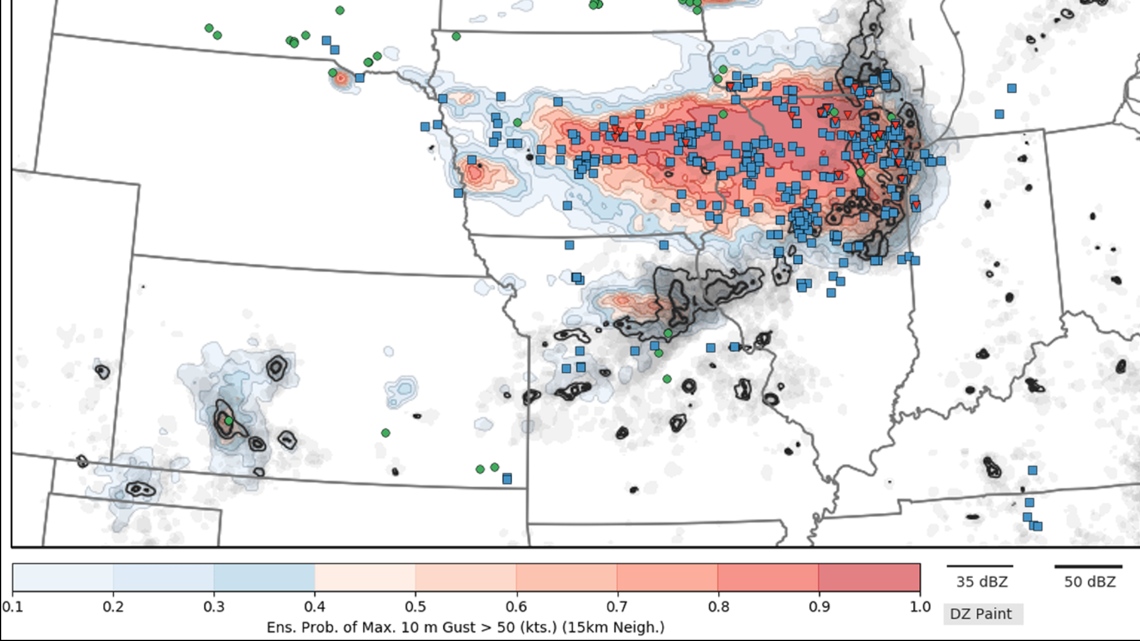
Had WoFS been operational last year, forecasters would have had higher confidence in forecasting severe weather.
They hope to have this available to forecasters 24/7 within the next five years.
"There's still a lot of work to be done," Skinner told Local 5. "We have to prove it's reliable. We have to prove we can run it every day."
If successful, WoFS will be just the latest advancement in a field that has come a long way over the past 20 years.
"The resolution that models were run with even in the early 2000s was not even capable resolving thunderstorms," Skinner said. "It has come a tremendously far way, and it's hopefully going to continue on that track in the next 20 years."
Local 5 is covering the one-year anniversary of the deadly August 2020 derecho. For complete coverage, click/tap here or text DERECHO to 515-457-1026.
WATCH: Drone video shows August 2020 derecho damage in Cedar Rapids

