DES MOINES, Iowa — June 1 marks the first day of meteorological summer, or the three-month period (June, July and August) scientists recognize as the beginning of the hottest time of year.
Meteorologists use the annual temperature cycle to designate seasons, rather than follow astronomical seasons based on Earth's rotation around the sun.
Despite it being the start of meteorological summer, the first 10 days of June 2022 will feel more like spring.
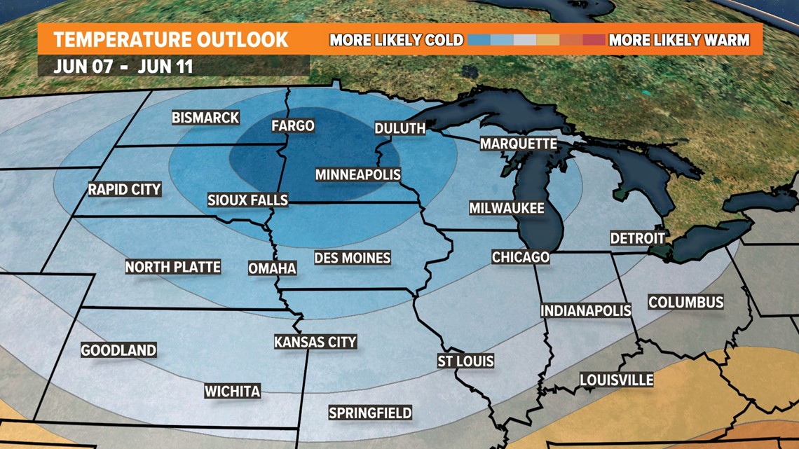
Near or below-average temperatures are forecast through at least the second weekend in June, according to the Climate Prediction Center's extended outlook. Long-range forecast data suggest the jet stream will be rather active over the Midwest in the beginning of June, a pattern that normally favors cooler and wetter weather.
This type of pattern usually prevents major warm-ups from arriving in the Midwest.
The Climate Prediction Center gives Iowa a 50-70% chance of seeing below-average temperatures during the second week of June, specifically from June 7-11.
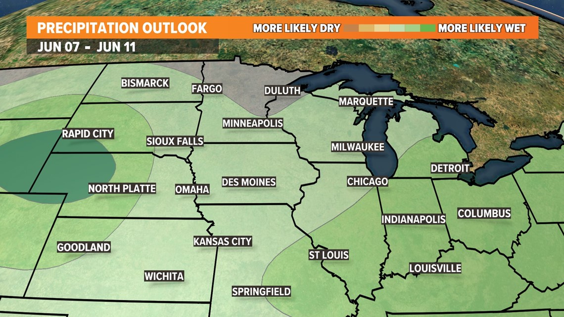
During that same timeframe, the Climate Prediction Center highlights a 30-40% chance of above-normal rainfall over Iowa.
NOTE: The average high temperature in Des Moines on June 1 is 78°, while the average morning low temperature is 58°.


There is an important caveat when higher rain chances enter the forecast in June: it is not common to receive widespread, all-day rain events at this point in the year.
Even a fairly high rain chance may indicate rain is likely in just one portion of the day or just one part of the forecast area.
When and where showers and thunderstorms occur is often dependent on the exact placement of cold fronts, warm fronts, stationary fronts and outflow boundaries leftover from prior rounds of storms.
A cooler and wetter forecast in early June, therefore, does not necessarily signal bad news for summer-lovers and those with planned outdoor activities.


