DES MOINES, Iowa — A significant improvement to Iowa's drought was reported by the U.S. Drought Monitor this week, a positive change after a recent stretch of wet weather across the state.
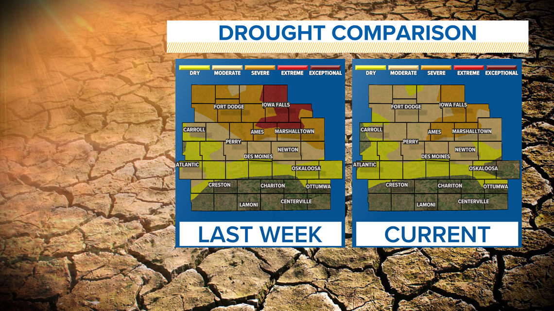
For the first time since the end of July, no areas of Iowa are considered to be in "extreme" drought.
Just last week, 10% of Iowa reported "extreme" drought conditions, including areas of Franklin, Grundy, Hardin, Story and Marshall Counties, to name a few.
The first section of "extreme" drought initially appeared in the state's drought monitor during the first week of August.
Furthermore, the area of "severe" drought in Iowa has dropped to its lowest level, at 13% of the state, since early June.
Nearly 60% of Iowa fell under the "severe" drought category in last week's update.
With the Sept. 2 U.S. Drought Monitor release, 13% of Iowa reported "severe" drought, 45% of Iowa reported "moderate" drought and 72% of Iowa reported abnormally dry conditions.


In other words, drought conditions have not ended across Iowa.
Instead, they have improved quite a bit.
The improvements are largely due to recent rainfall in Iowa, including the heavy thunderstorms in northern Iowa between Aug. 26-27.
During that timeframe, parts of northern Iowa near the Minnesota border experienced more than 5" of rain within a few short hours.
As of Sept. 1, Des Moines has recorded 19.44" of precipitation for the entire year, while the average number would be a little over 27".
The city is still close to 8" inches below average for annual precipitation.
Moving forward into September, the Climate Prediction Center forecasts a drier pattern for at least a few weeks.
Although rain is still possible during this time, the likelihood of seeing further significant adjustments to the ongoing drought seems slim.

