DES MOINES, Iowa — As summer ends and fall officially begins, drought conditions are still getting worse in parts of Iowa.
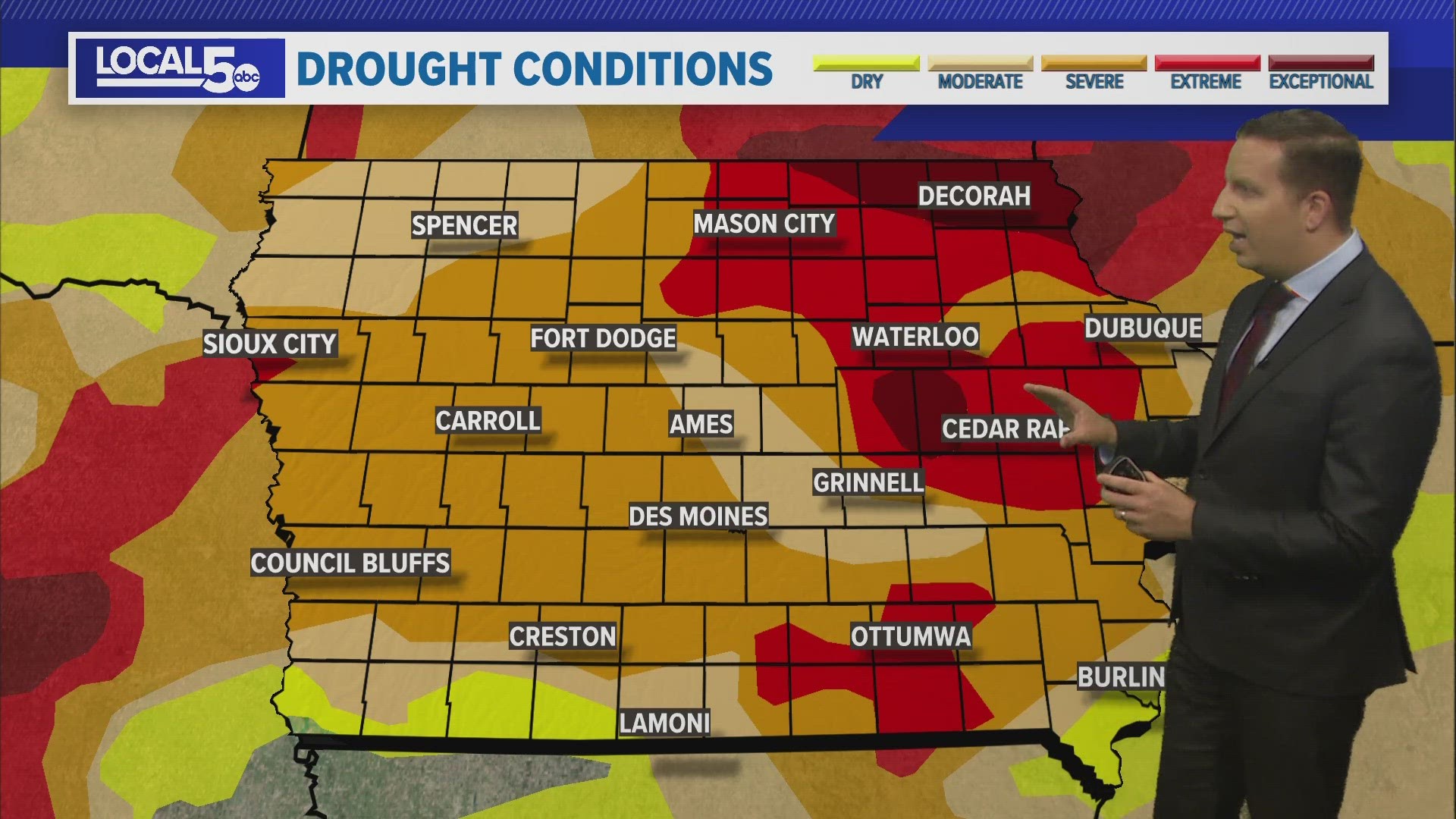
On Thursday, the U.S. Drought Monitor revealed two zones of 'exceptional' drought - both are located in eastern Iowa.
Exceptional drought is the highest classification of drought possible on the U.S. Drought Monitor's scale.
Eastern Tama County and western Benton County make up one of those areas.
Cities like Dysart and Vinton, among others, are dealing with year-to-date rainfall deficits of more than 13 inches.
The other area of exceptional drought is in far northeast Iowa, in Allamakee, Howard, Mitchell and Winneshiek Counties.
Towns like Cresco, Decorah and Waukon are the driest of anywhere in the entire state.
These two regions of exceptional drought make up 5% of Iowa.
According to Iowa's State Climatologist, Dr. Justin Glisan, this is the highest extent of exceptional drought in Iowa since the U.S. Drought Monitor was first created 23 years ago.
97% of Iowa is in some sort of drought, up 3% from the update released on Sept. 14.
'Extreme' drought covers a lot of the state east of I-35, including cities like Cedar Rapids, Ottumwa, Mason City, and Waterloo.
Metro Des Moines is in an area of 'severe' drought, although this does not account for the meaningful rain on Tuesday, Sept. 19, when 1.49" of rain fell at the Des Moines airport.
The U.S. Drought Monitor says "the data cutoff for Drought Monitor maps is each Tuesday at 8 a.m. EDT."
With this week's update, an estimated 2,986,730 Iowans live in drought-stricken areas.
Exceptional drought causes a variety of issues for Iowans, but these are a few of the most prominent ones:
- Aquatic invertebrates in waterways increase
- Extreme measures are taken to conserve water
- Row crop yields and forage production have significant impacts

