NEW ORLEANS —
TROPICAL STORM SALLY
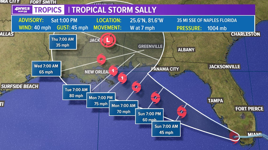
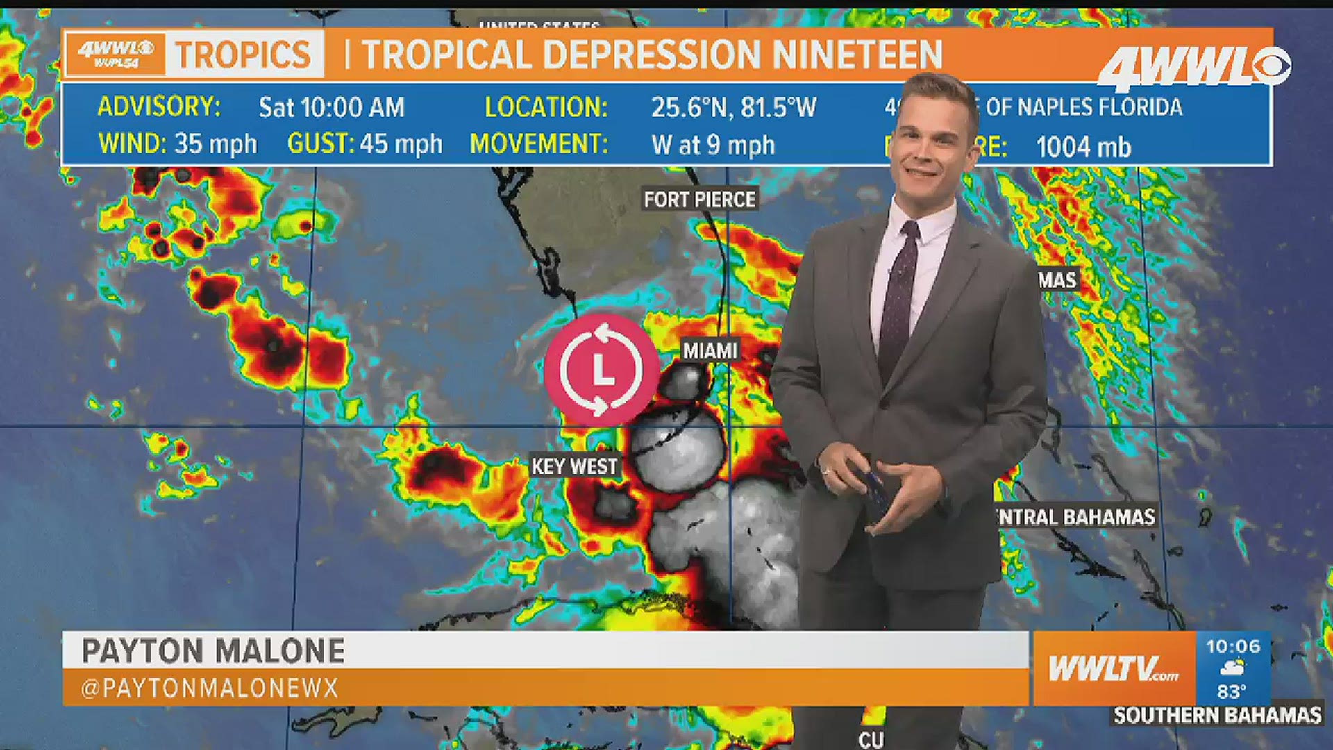
As of 1 PM Tropical Depression 19 has strengthened into a Tropical Storm Sally. was moving into the Gulf of Mexico. Winds are 40 mph with movement west at 7 mph.


Tropical Storm Sally is expected to strengthen more as it moves northwest toward the northern Gulf Coast and is forecast to become a hurricane before landfall Tuesday. There are still uncertainties with the track and intensity, but the current forecast would bring a few inches of rain, strong winds and surge into parts of Southeast Louisiana and south Mississippi by Monday and continue through Wednesday.
It's very possible this storm strengthens more than the current forecast, so it's important to check back for updates this weekend.
Unfortunately, it looks like the storm will really slow down on its approach to the area, which means flooding rain could become a major concern for areas near and east of the center. Who picks up the most rain will depend on the exact track.
ATLANTIC
Aside from the discussion of the wave and depression threatening the Gulf of Mexico, we also have two named storms, Paulette and Rene. Paulette will threaten Bermuda Monday as a stronger hurricane and Rene not expected to affect land.
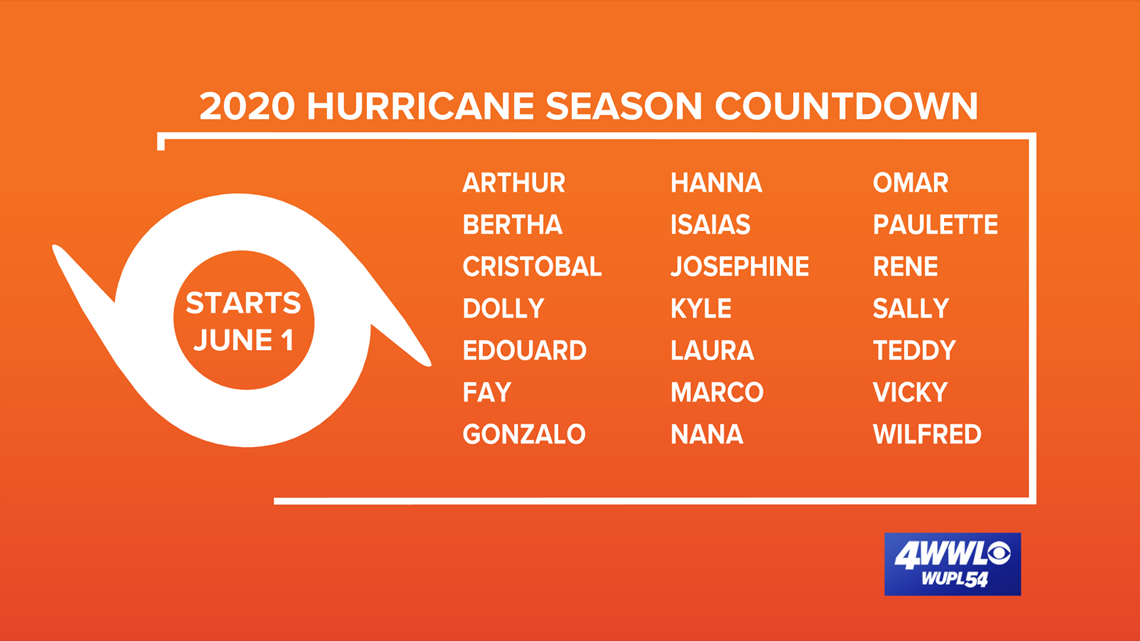
Invest 95L, currently southwest of the Cabo Verde Islands, has a high chance for development. It's a race to see whether 95 or 96 gets named first, with the next two being Sally and Teddy. Too far out to know what it could eventually do. We'll focus on that after next week. Another wave just emerging off the African coast has a medium chance for development in the next 3 to 5 days.
Tracks, Models, Radars
Atlantic Ocean
Paulette and Rene continue in the Atlantic. We could see both storms strengthen to hurricanes, however, Paulette is the only threat to land as it may near Bermuda by early next week.
All the other "systems" being highlighted by the NHC are waves (although one is still a cluster of thunderstorms over Africa) with a potential for development. So when there is only a potential, we rely on computer models. And until a storm has a more defined structure, models are not consistent.
HURRICANE CENTER: Latest Tracks, Models & Radar - Click here.
► Track the tropics with live updates delivered directly to your phone. Text APP to 504-529-4444 to download the FREE WWL-TV News app now or find us in the iOS App Store or Google Play.
_________________________________
Hurricane season forecast to become "extremely active"
NOAA released their August hurricane season forecast update and called for an 'extremely active' season. The forecast called for 19-25 named storms, 7-11 hurricanes and 3-6 major hurricanes. These numbers already include nine named storms and two hurricanes.
The reasons for the extremely active season:
• Warmer than normal sea surface temperatures in the Atlantic and Caribbean
• Enhanced West African Monsoon (rainy) season - causes tropical waves
• Possible La Nina forming in the months ahead
• Reduced wind shear over the Atlantic basin - allows storms to develop
Now is the time to be prepared. Typically, the season becomes more active in the next week or two with the peak on September 10th.
The expert forecasters at Colorado State issued their August update on the 2020 hurricane season. Their forecast now calls for 24 named storms (total for the season), 12 hurricanes and five major hurricanes.
That's an increase of four named storms, three hurricanes, and one major hurricane.
Should there be 24 named storms, they would run out of names and have to go to the Greek alphabet, like in 2005.


---
► Sign up for the 4 Things to Know email newsletter to get tropical weather headlines delivered to your inbox. Click here to sign up!


