
DES MOINES, Iowa — Friday's rain caused major flooding and devastation across several communities in northwest Iowa. Now, floodwaters in the Des Moines River basin are making their way down river towards Saylorville Lake, which is built to help protect the Des Moines metro from upstream flooding.
Saylorville is catching this floodwater and rising quickly. It is expected to rise to a level just 10 feet short of the emergency spillway, 18 feet with temporary gates are raised in the spillway itself.
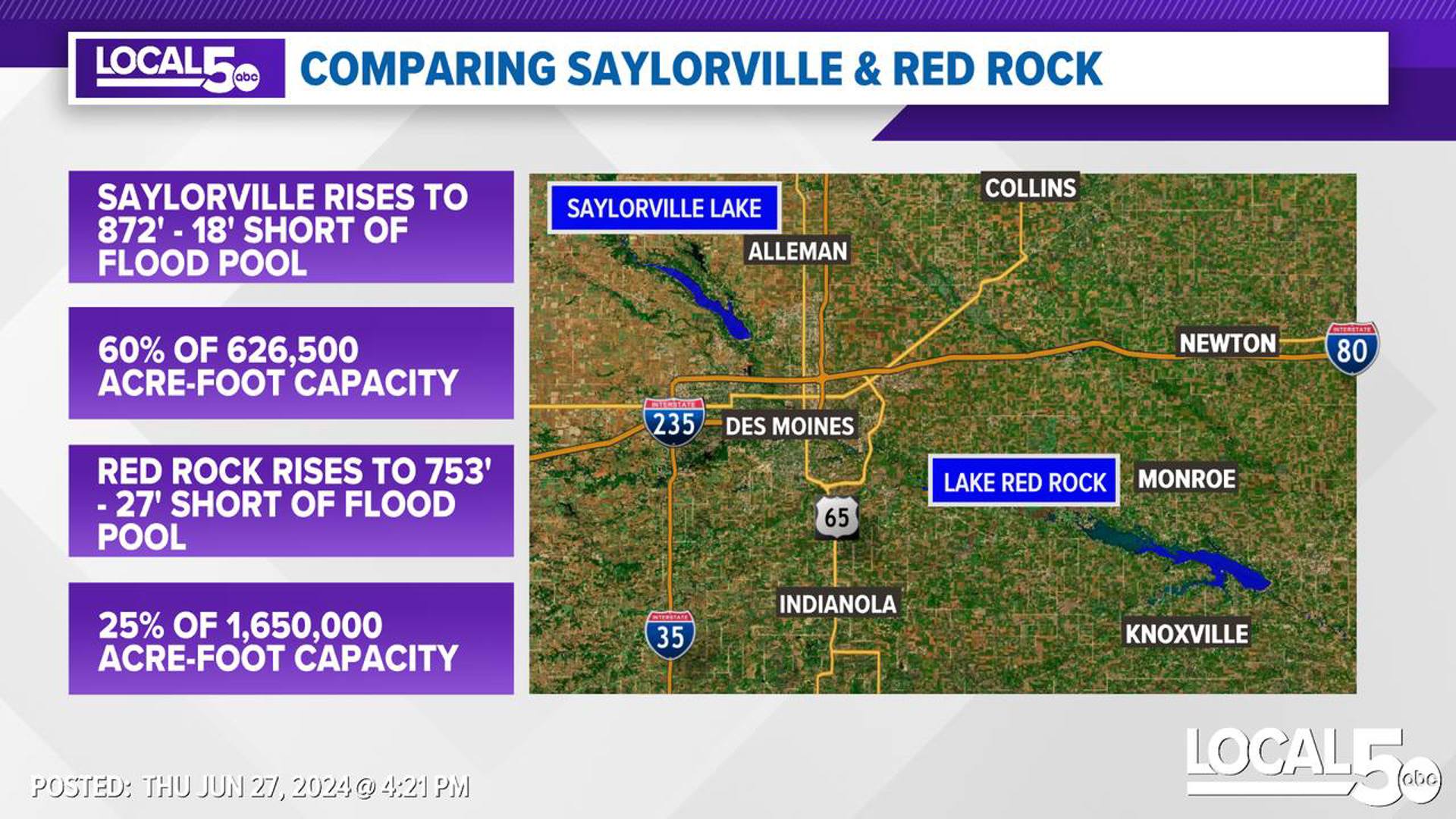
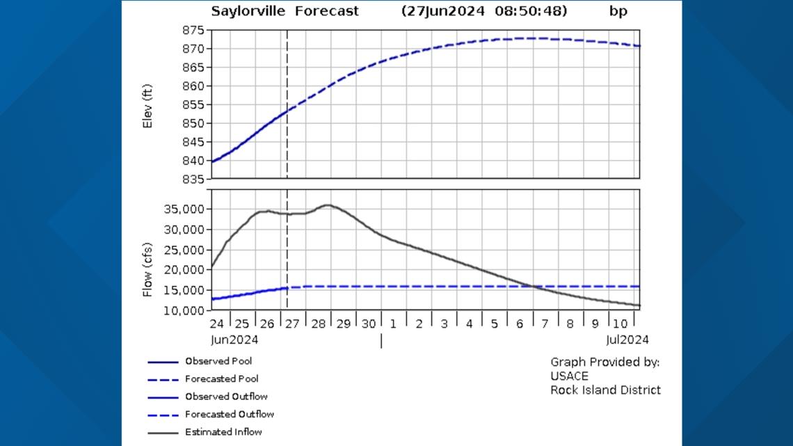
As of Sunday, the water level at Saylorville was at 838 feet. The current forecast from the Corps of Engineers shows the crest of around 872 feet on July 6, with the lake level rising 34 feet.
While the lake is rising, comparing the rise of lake level to the volume of water the reservoir holds are not linear. As the levels rise, the carrying capacity of Saylorville also increases.

At the forecast 872 feet crest that will utilize only about 60% of the reservoir's storage capacity, despite only being 18 feet away from flood pool. At 872 feet, the storage is just over 375,000 acre-feet of water. At flood pool elevation of 890 feet, the storage is about 626,500 acre-feet.
While Saylorville is holding back a lot of the water, it is discharging water downstream at a rate to keep bank full conditions through the Des Moines area. Further downstream, a second reservoir, Lake Red Rock, will serve to moderate that flow along the Des Moines River.
Lake Red Rock is also beginning to rise. The current forecast crest is expected to a level around 753 feet, 11 feet higher than the lake level on Thursday evening.
At 753 feet, the lake is only filled to 25% of Red Rock's flood storage capacity. At 753 feet, the storage capacity of Lake Red Rock is around 423,500 acre-feet. At the flood pool elevation of 780 feet, Lake Red Rock's storage capacity is around 1,650,000 acre-feet, making it roughly 2 1/2 times larger than Saylorville Lake's capacity.
So what does that mean? One more identical rain event exactly like what unfolded on Friday would mean certain disaster for communities in northwestern Iowa. That water would once again migrate downstream towards Saylorville.
Assuming outflow was left unchanged, that identical rain would push enough water into Saylorville to fill it over capacity. Water would then eclipse the emergency spillway leading to at least some impact into Des Moines if this were to happen any time over the next two weeks.
It would take four identical rains in the Des Moines basin like last Friday to fill both reservoirs to the top. Should that happen, there would be significant flooding all along the Des Moines river, including the Des Moines metro.