IOWA, USA — We've been hinting at the first snowflakes of the season being possible this weekend.
It definitely does not feel like it if you step outside on Thursday as temperatures are still mild. But that will change Thursday night into Friday morning. The first piece of the forecast will be a cold front diving across the state early Friday morning. Temperatures will go from the mid-60s to upper 40s and low 50s in just a few minutes. This plunge will be reinforced with a secondary shot of colder air arriving from the northwest into Saturday.
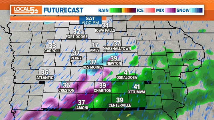
By Saturday, temperatures will be dropping into the 30s, especially by evening in central Iowa. Northwest Iowa will be down near freezing through the day.
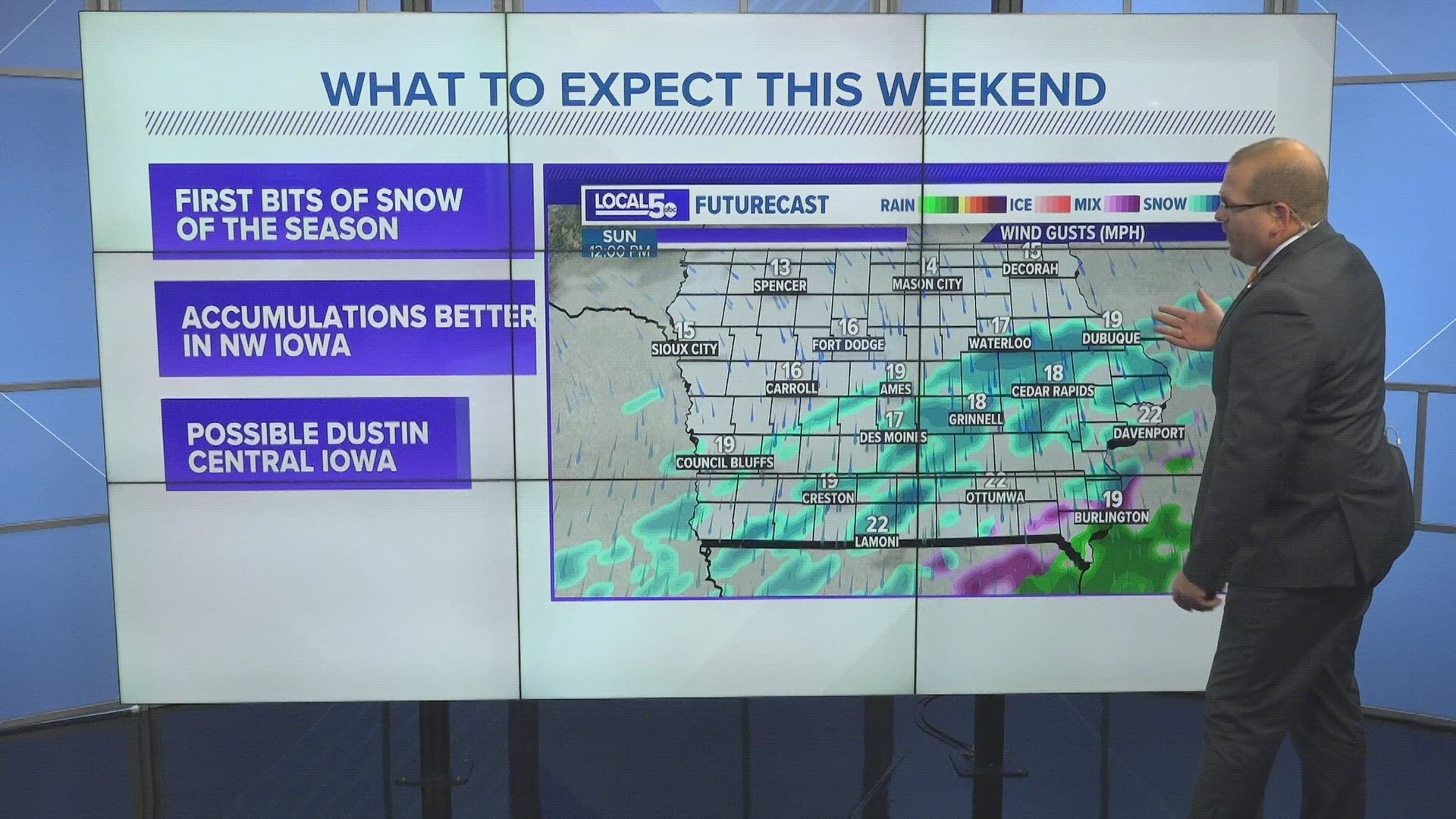
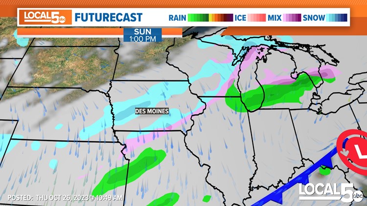
A disturbance moving through on Saturday evening and night into Sunday will be the focus for possible snow. Overall, it's a minor wave sliding through. It appears two general bands will need to be watched: one will be over northwest Iowa and one over central and southern Iowa a bit later in the period.
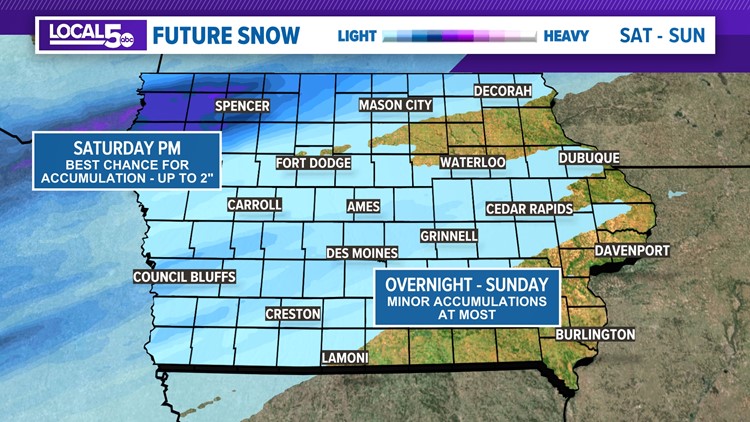
Northwest Iowa will have the best chance to pick up something a bit more impactful. The timeframe to watch will be midday Saturday into the evening. While still ultimately light, the cooler setup in this area will lead to a more favorable scenario where snow will stick around on the ground.
Grass coverage will occur first, but impacts on pavement may be felt. Accumulations of a dusting to as much as 2" will be possible in the areas surrounding Sioux City to Algona with the fringe being near Rockwell City and Fort Dodge.
Snow possible this weekend
Further south, closer to the Des Moines metro and southern Iowa, the scenario is more complicated.
Overall, conditions are warmer and the timing on Sunday would pin arrival in the middle of the day into the afternoon. The intensity of the precipitation in this band will generally be light and some rain and mix will likely be involved. All these factors are negatives when it comes to snow actually sticking around. If the intensity does allow for snowflakes to stick, accumulations are likely kept to a minimum and only on grassy or elevated surfaces.
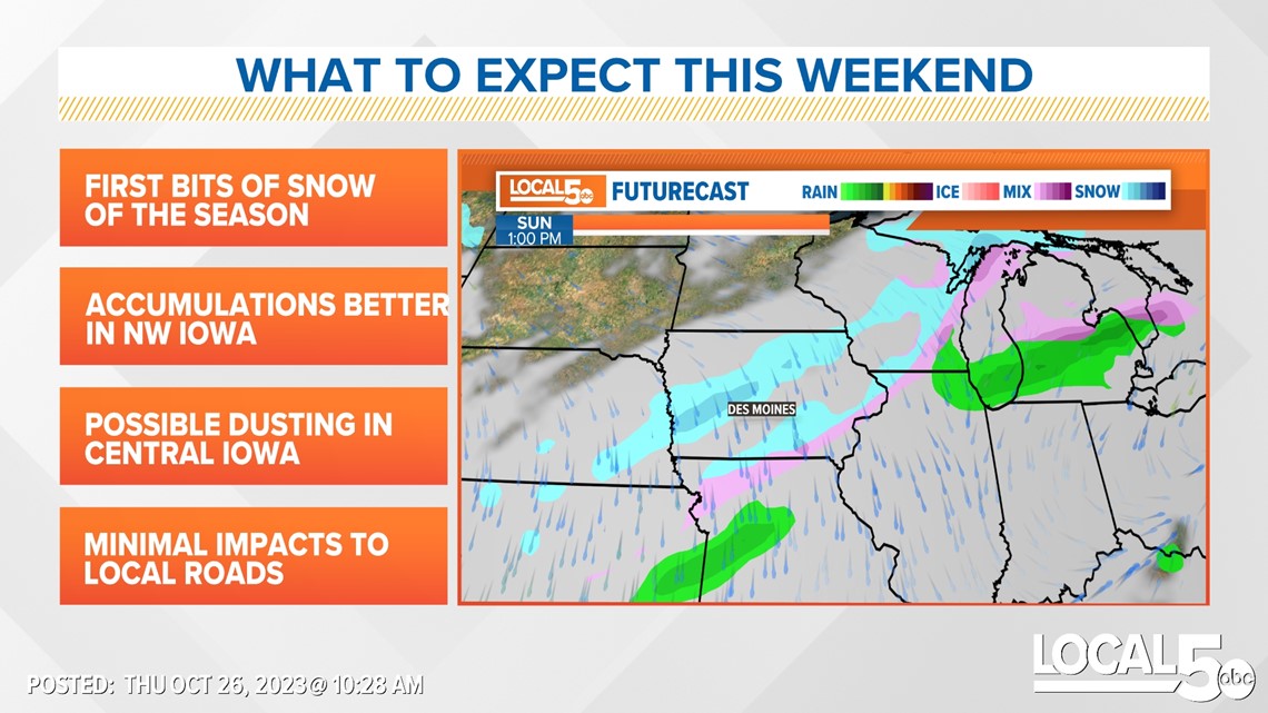
The areas most likely to see a few snowflakes would be on a line from Red Oak and Atlantic through the metro toward Iowa City.

So what's most likely in and around Des Moines?
We see some showers with a few snowflakes mix in. If the intensity is right and we can turn over to all snow for a short time, a grassy dusting is possible. There will likely not be any impacts felt on the roads besides being wet.
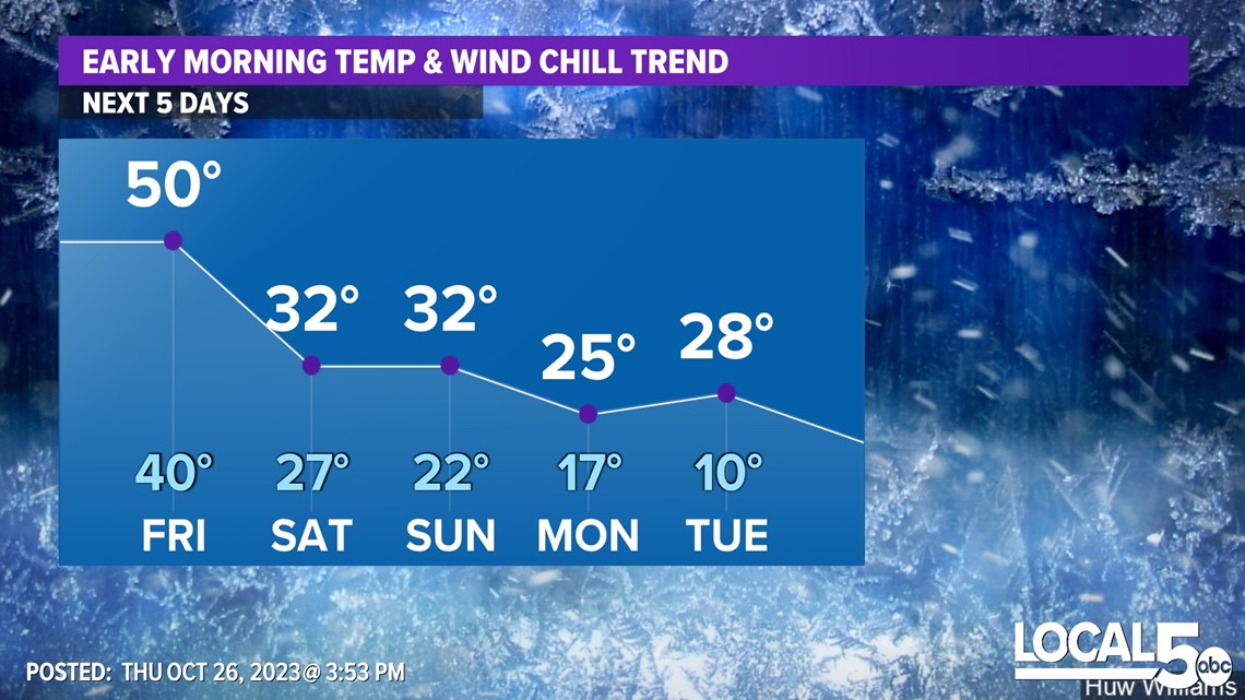
However, it will be chilly. Highs will be in the upper 30s to about 40 on both Saturday and Sunday. Overnights will dip towards freezing and early next week, we should dip well back into the 20s to end the growing season efficiently.
Wind chills will be back into the 20s during the overnight this weekend. Wind chills in the teens will be felt Sunday night into Monday and again Monday night into Tuesday.

Snow statistics for Des Moines
Getting snow this early in the season does happen, but it is ahead of with is considered normal.
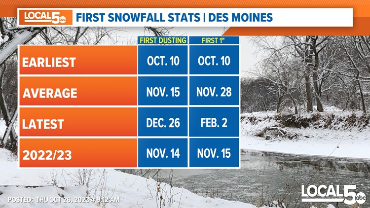
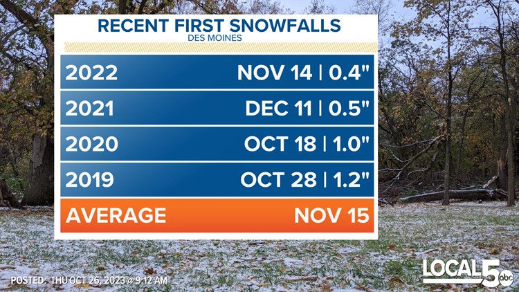
That average first measurable snow is around Nov. 15. In the last four seasons, the first measurable snowfall of the year in Des Moines happened in October in two of those seasons, 2019 and 2020.
The earliest measurable snow on record for Des Moines is Oct. 10, which happened in 2009. The latest first measurable snow was the day after Christmas (Dec. 26) in 1939. And we've gone over the New Year waiting for that first inch of snow several times, the latest of which occurred on Feb. 2, 1989.

