IOWA, USA — The Local 5 Weather team forecasts storms firing off throughout afternoon and into the evening.
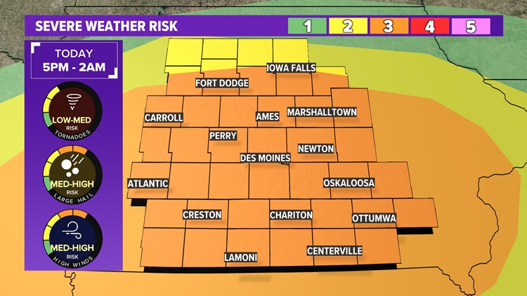
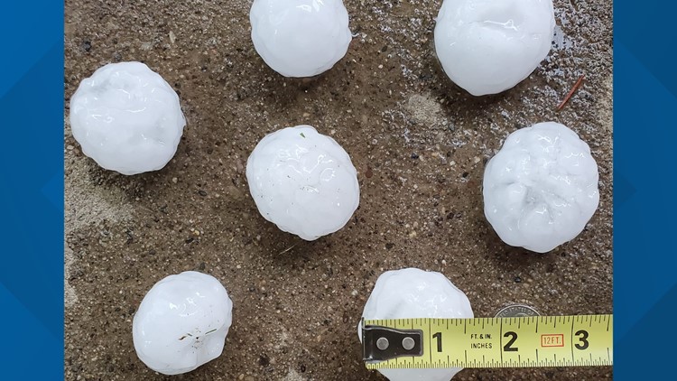
Large hail is the biggest threat to storms that form today; hailstones up to tennis ball or even bigger have already occurred or are possible thru the evening.
The tornado threat will be highest between 5 and 9 p.m. After that, damaging straight line winds will take over, especially in southern Iowa. Threat will wrap up around 1 or 2 a.m. from west to east.
A level 3/5 risk for severe weather is in effect on Sunday for all Iowa counties along and south of Highway 20.
You can read the full forecast here.
Stay Weather Aware!
Latest Updates
A Severe Thunderstorm Warning is in effect for the following counties Sunday:
- Adams (9:45 p.m.)
- Adair (9:45 p.m.)
- Madison (9:45 p.m.)
- Taylor (9:45 p.m.)
- Union (9:45 p.m.)
A Severe Thunderstorm Watch is in effect for the following counties Sunday:
- Polk (until midnight Monday)
As hail pummeled parts of Iowa, traffic cams caught some of the sights.
Power Outages
These outages were updated at 9:45 p.m. Sunday. For real-time outages, visit the MidAmerican or Alliant website.
Reported MidAmerican outages
*Customers, by metro area
- Council Bluffs: 165
- Des Moines: 123
- Iowa City: 2482
- Quad Cities IA: 36
Total: 2781
Reported Alliant outages
*Customers, by county
- Cedar: 159
- Clinton: 100
- Des Moines: 765
- Henry: 404
- Iowa: 1
- Jasper: 41
- Johnson: 759
- Keokuk: 334
- Lee: 123
- Linn: 199
- Louisa: 87
- Marshall: 2
- Muscatine: 298
- Poweshiek: 15
- Scott: 2
- Story: 360
- Wapello: 1
- Washington: 375
Total: 6,798


