
IOWA, USA — Iowa is in for a large round of severe weather Tuesday, with strong storms moving northeast across southern Iowa as midday nears.
The storms have been known for gusty winds to 50 mph but have generally stayed sub-severe for now. Additional activity is expected from the south later Tuesday, where the threat will generally target the southern and eastern sides of the state.
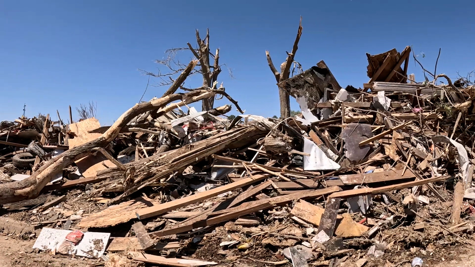
The National Weather Service confirmed a tornado east of Minburn around 11:15 a.m.
A round of thunderstorm development begins Tuesday morning in western Iowa and quickly strengthens as it moves across Iowa. This line of storms will feature embedded supercells capable of high wind, large hail and tornadoes. The window of opportunity will be 8 a.m. to 7 p.m. in central Iowa.
This first line should be pushing through the metro around noon.
A few more storms are likely to develop mainly south and east of the metro later Tuesday afternoon which could certainly be severe again including the risk for tornadoes. The good news with all these chances for showers and storms is that most areas should get at least 1" of rain with some picking up more than 2" with some of the heavier storms.
3:12 p.m. — A Tornado Warning has been issued until 4 p.m. for Pocahontas, Humboldt, Kossuth and Palo Alto counties.
2:55 p.m. — A Severe Thunderstorm Warning has been issued until 4 p.m. for Wapello and Davis counties.
2:37 p.m. — A Tornado Warning has been issued until 3:15 p.m. for Calhoun, Pocahontas and Humboldt counties.
1:03 p.m. — A Severe Thunderstorm Warning has been issued until 2 p.m. for several counties including Marion, Lucas, Jasper and Monroe.
11:28 a.m. — An updated Tornado Watch has been issued for southern and central Iowa until 6 p.m., including Des Moines and Ames.
Tornado Watch vs. Tornado Warning
In a Tornado Wtch situation, all of the elements needed to form a tornado are present, but one hasn't formed quite yet.
Just as the name suggests, a Tornado Watch urges people to keep an eye out on the current situation. There are possible tornadoes in the area, so it's best to be prepared and keep an eye on local forecasts.
Watches are issued by the Storm Prediction Center for counties where tornadoes are possible.
When a Tornado Warning is issued, that means tornadoes are happening right now. The threat is immediate, and you should take action to keep you and your family safe.
Once a warning is issued, it's recommended by the National Weather Service to "Move to an interior room on the lowest floor of a sturdy building. Avoid windows. If in a mobile home, a vehicle, or outdoors, move to the closest substantial shelter and protect yourself from flying debris."