
WEST DES MOINES, Iowa — Hopefully you enjoyed your break from severe weather because it is unfortunately making a return.
Tonight: Another clear, quiet night with lows in the 50s. A pop-up shower or two is possible, but it will mainly stay towards the east. Some of those showers may contain small hail.
Tomorrow: Temperatures warm up into the 80s again, but it won't be as warm as it was on Saturday. For the most part, it will be a nice day. There will be some storms moving through during the afternoon hours, and some could be severe, so be weather aware if you have plans during that time.
Tomorrow Night: We will see some more showers and storms roll through the state late night and early morning Monday, but these are not expected to be severe. Some could have heavy rainfall and some thunder with it.
Monday: Showers and storms move out by the morning, and we have a break from the rain for a while. As we hit the evening hours, some storms will start to pop-up, and they have the chance to be severe. However, the best chance for severe storms comes early Tuesday morning.
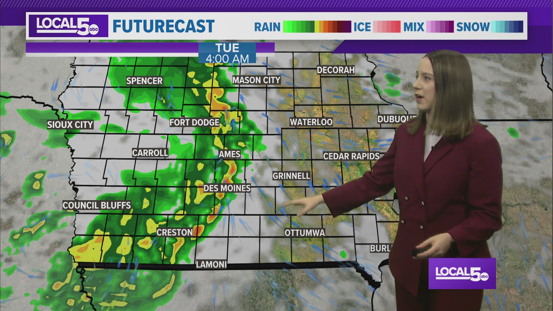
Next Week: Early morning Tuesday a line of storms, likely to be severe, will roll through the state. These storms have the potential to carry all the severe threats. As we inch closer to the day, we will have more details on what exactly to expect and when to expect it.
After Tuesday, our rain chances go down and we will have a couple days to dry off with highs in the 70s. Unfortunately, Memorial Day Weekend could have some showers and storms.
Enjoy your weekend!