
WEST DES MOINES, Iowa — This last week of summer has been a warm one for sure. We have had 6 straight days of above average temps with highs in the upper 80s to low 90s. Saturday, the last day of summer, will also reach the upper 80s for some locations. Appropriately, a cool down is coming in on the first day of fall, which is Sunday. Thankfully, our rain chances will be coming back up by late Saturday into early Sunday.
Look for mostly clear skies this evening. It will be warm and dry until after midnight when we will have a chance for some thundershowers- mainly over the southern counties of Iowa. Lows drop off into the 60s one last night before seasonal lows in the 50s take over.
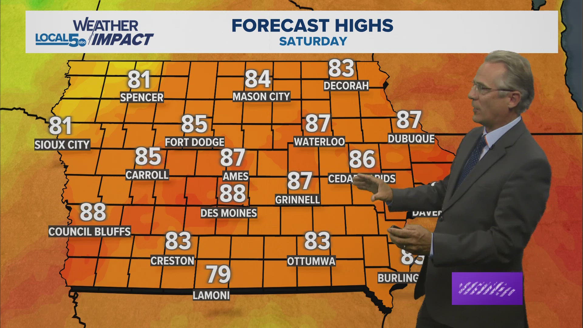
There may be some isolated showers Saturday morning, mainly for areas to the south, but most start the day dry with sunshine. As clouds increase through the day, scattered rain and thundershowers take over by late afternoon and especially into the evening. The Cyclone game likely begins dry, but thunderstorms could impact the toward the end of the game. Pack a poncho just in case! Highs have trended warmer for Saturday, now topping in the muggy mid to upper 80s on a SSW wind at 10-20 mph.
Sunday is the first day of Fall, and with perfect timing, we are going to be COOL for the first time in a long time. Mostly cloudy skies, northern winds and temperatures in the 60s will give us that "fall feel". It will likely be wet in the morning with some showers around- especially over southern Iowa. But it looks drier in the afternoon.
Have a great weekend!