
WEST DES MOINES, Iowa — Parts of southern Iowa received 2-4" of rain yesterday. Most of the flooding occurred in Wayne, Wapello, Monroe, Lucas, and Appanoose counties. In Wapello county, north of Blakesburg, there was a report of 6" of rain yesterday!
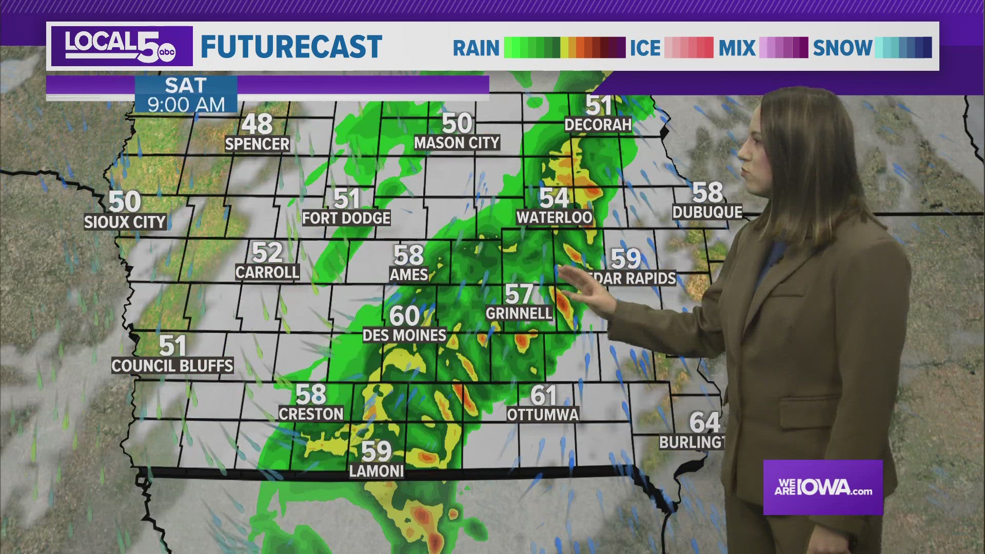
Overnight: Clouds increase as we go into the late afternoon and evening. A line of showers and storms will enter our western counties in the early morning hours of Saturday. There may be some small hail and strong winds, but these storms should remain sub-severe. Lows drop in to the upper 40s north to upper 50s south.
Saturday: The line of showers and storms continues to push east through the early morning hours and exits our eastern counties by the afternoon. Skies gradually clear throughout the afternoon from northwest to southeast. Highs top cooler in the 60s with a northwest wind around 10-15 mph.
Sunday: A much needed chance to more your lawn with sunny skies and highs back near 70°. The wind turns easterly around 5-10 mph. It will be another perfect day to enjoy before more rain arrives.
Next Week: On and off chances for rain beginning Monday late evening into the overnight. Some of these storms have the potential to be on the stronger side, so stay tuned to the forecast. Lows through next week remain largely in the 40s and 50s with highs staying spring-like in the 60s and 70s.
Happy Friday!