
WEST DES MOINES, Iowa — 2024 has been an abnormal year when it comes to weather. We started off with back-to-back blizzards in January, had the coldest Caucus ever and we recently went through the sixth driest September on record!
We are slowly nearing the winter season, and with how unusual the weather has been this year, it's easy to wonder if that trend will continue.
The NOAA (National Oceanic and Atmospheric Administration) just released its predictions for the 2024-25 winter season, and things could get interesting. We may be ending this year with more weather abnormalities if the predictions hold.
Temperatures
NOAA has Iowa highlighted in the 50/50 zone of seeing either colder or warmer than usual temperatures during December, January and February. However, in the next three months, Iowa could be seeing slightly warmer than average temperatures.
We may be in for another mild winter season if these predictions hold up. The average temperatures in the state of Iowa range from 18 to 25 degrees during the winter season.
Precipitation
NOAA again has Iowa highlighted in the 50/50 zone of seeing above or below normal winter precipitation this winter season. However, it says northeastern Iowa can expect above normal precipitation this season.
Usually, the state of Iowa sees around 20 to 35 inches of snow during the winter months, with around 4 inches of other precipitation.
Drought
On top of the temperature and precipitation predictions, the NOAA and NIDIS (National Intergrated Drought Information System) also released a seasonal drought outlook.
Unfortunately, the drought is expected to persist for about 75% of Iowa through the winter season. On the other hand, it showed that a majority of southern Iowa may be out of the drought by the end of the winter.
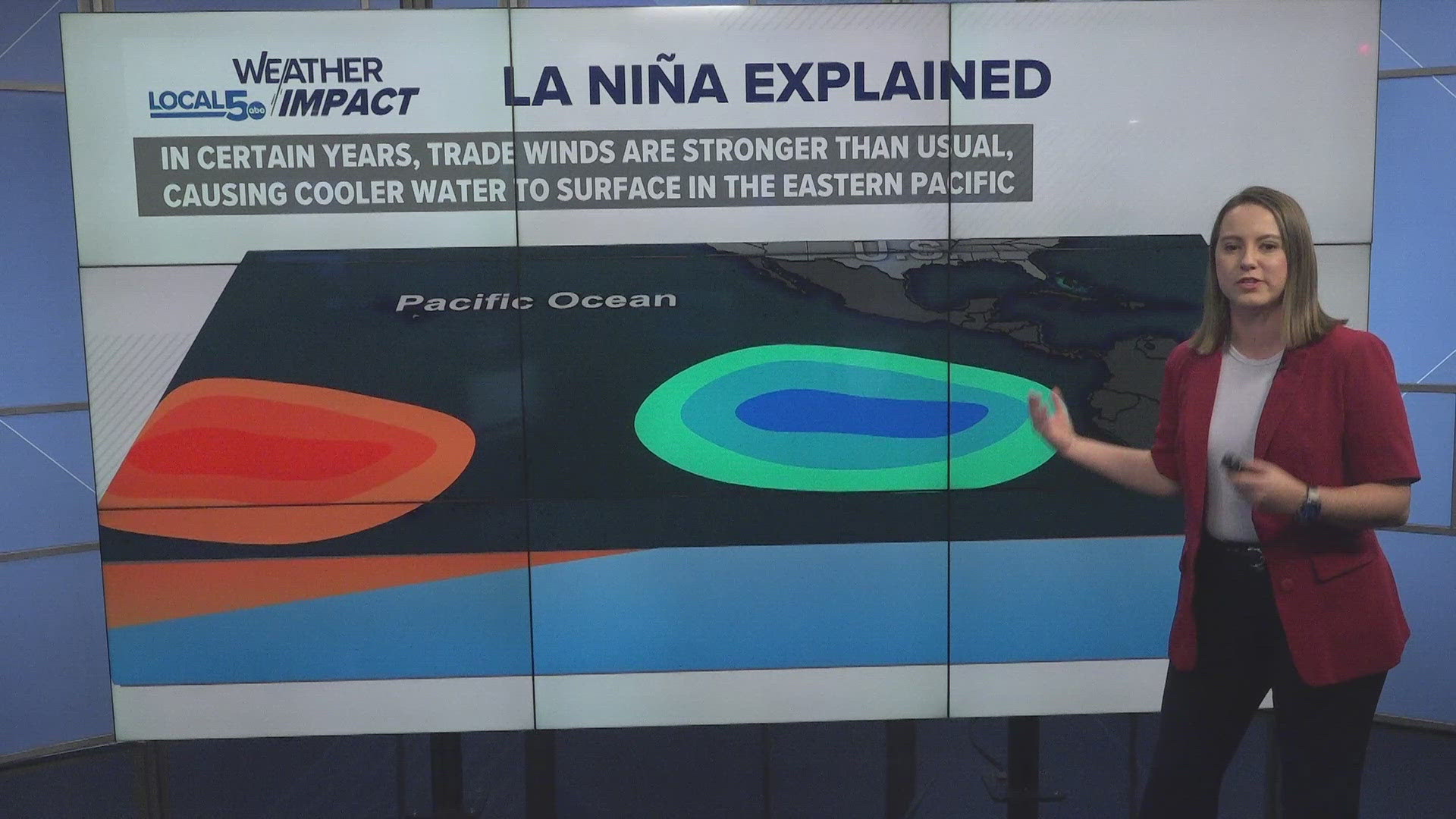
La Niña Pattern
As we move into this winter season, we are also slowly moving into a La Niña weather pattern. A La Niña weather pattern has the opposite effect of an El Niño weather pattern.
During La Niña, trade winds are usually stronger than usual which pushes more warm water towards Asia, allowing cold water to surface off the West Coast. The cold waters push the jet stream north into the colder air up near Alaska and Canada.
With the jet stream up that far, it usually brings that colder air down towards the Midwest. During this weather pattern, the Pacific Northwest can expect heavy rain and flooding, while the South usually sees a drought.
For us back home, La Niña usually brings cooler and wetter conditions to the state of Iowa during the winter months, so mixing this with NOAA's winter season predictions mean we are truly in for an interesting weather season.